61 / 62
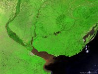
Rio de La Plata, Argentina
The Río de la Plata is the estuary formed by the confluence of the Uruguay River and the Paraná River on the border between Argentina and Uruguay. It is a funnel-shaped indentation on the southeastern coastline of South America, about 290 kilometres long. This nearly cloud-free 300 m image of 7 October 2013 nicely shows the confluence of the two mentioned rivers into the estuary. The sedimentation in the estuary is also visible by the brownish colors.
Date: 07/10/2013
Resolution: 300m
