6 / 16
Kabompo, Zambia
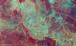
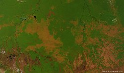
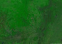
In celebration of the International Day of the Forests on 21 March, we take a look at a remote and evergreen dry forest ecosystem in Zambia. It stretches out from West Lunga National Park to the northeast towards the confluence of the Zambezi River and the Kabompo River and the broad, annually flooding Barotse Floodplain further to the southeast. This ecosystem, comprising of several areas in Zambia, separated by grasslands, and one area crossing into Angola, is standing on infertile sandy soil with little surface water, which leaves the forest fairly undisturbed.
The Kabompo River, one of the main tributaries to the Zambezi, extends southwestward from the northeast corner of the above false-colour image, captured by PROBA-V in mid September 2015. In the southeast of the image and extending further south between the Kabompo River and Luena River lies the Kabompo Protected Forest Area.
The image is further transected by a number of smaller rivers flowing north-to-south, such as the Nyela, Mumbeji and Lutali.
Date: 15/09/2015
Resolution: 100m
