12 / 41
Niangay, Mali
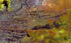
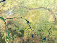
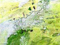
This week’s false-colour image shows the interplay of emergent sand ridges, canals and lakes, such as Lake Fati, Lake Niangay, Lake Do and Lake Aougoundou in the northern part of the Inner Niger Delta in Mali. Just south of the Sahara Desert, the Delta forms an oasis amidst its semi-arid surroundings and sustains for instance palm and gum arabic trees on the ridges and the African manatee (sea cow) in the rivers.
The Niger River, flowing in its atypical curve-shape, is the source of livelihood for many Sahelians. This portion of the river flows northward between the grasslands on the floodplains of the lower Inner Niger Delta and the familiar town of Timbuctu to the northeast.
Lake Niangay, the largest lake in this daily synthesis image, is the second largest lake of Mali and is about to be refilled by the July-October rainy season.
Date: 25/06/2016
Resolution: 100m
